A Structured Annotation Framework with Multi-Layer Quality Assurance
To deliver the high-quality training data required for the client's AI model, we implemented a systematic data annotation approach that prioritized accuracy, consistency, and scalability. All drone image labeling was conducted using the client's proprietary annotation platform.
Comprehensive Annotation Guidelines and Training
We began by developing detailed annotation guidelines in collaboration with the client, establishing clear criteria for identifying bird nests and marking boundaries. These guidelines included visual examples of various nest types, materials, and configurations, as well as edge cases (such as partially obscured nests, debris versus actual nests, and ambiguous scenarios). Our annotation team underwent thorough training on these standards to ensure uniform interpretation across all images.
Object Classification and Bounding Box Annotation
Each image underwent a two-step annotation process to capture both binary classification data and spatial location data:
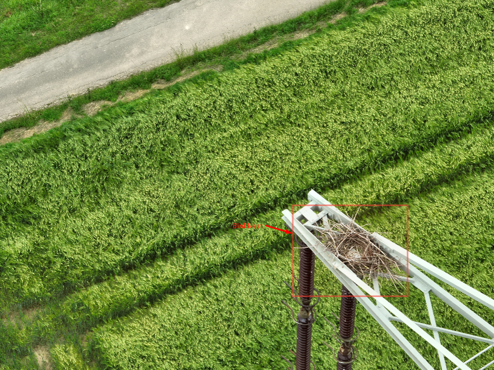
- Classification: Determining whether a bird nest was present or absent in the image
- Annotation: (for images containing nests): Drawing precise bounding boxes around each nest's location, capturing the full extent of the nest structure
Multi-Tier Quality Assurance Workflow
To maintain the accuracy standards critical for AI model training, we implemented a rigorous quality assurance process:
- A team of trained annotators labeled images according to the established guidelines.
- The labeled dataset underwent cross-verification by secondary annotators to identify inconsistencies.
- Senior reviewers conducted quality checks on completed batches, focusing on edge cases and areas of potential ambiguity.
- All identified issues were documented and shared with the annotation team.
- Annotation guidelines were refined as needed to address recurring challenges.
Handling Edge Cases and Ambiguities
For images where nest presence was unclear or debatable, we established an escalation protocol to resolve any discrepancies. Ambiguous cases were flagged and directed to subject matter experts for review, with decisions documented to maintain consistency in similar future scenarios. This approach minimized subjective interpretation while preventing annotation drift across the dataset.
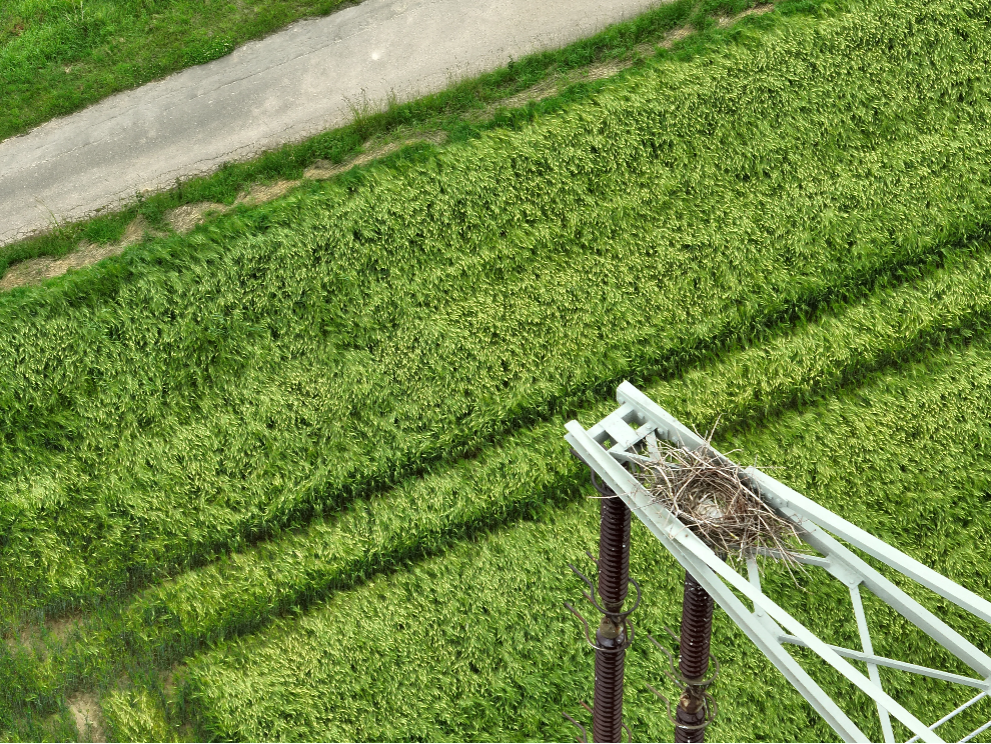
Raw image
Annotated image