Using QuPath for Large-Scale Livestock Image Annotation
Addressing the challenges of annotating drone images at a large scale required a workflow that balanced precision, efficiency, and system performance. We developed a QuPath-based annotation pipeline tailored to aerial livestock data—enhanced with standardized labeling protocols, a trained annotation team, and automated export scripts. Here is a quick breakdown of that solution.
Establish Clear and Consistent Image Annotation Rules
To ensure consistency in image labeling, we defined clear annotation guidelines.
- Defined clear rules for handling lighting issues, shadows, and low-contrast animals.
- Specified how to differentiate cattle from similar background objects such as vehicles, troughs, or dark patches.
- Provided guidance for labeling overlapping or partially visible animals to ensure every animal was counted.
- Compiled a reference guide of correctly annotated examples as a visual standard for all annotators.
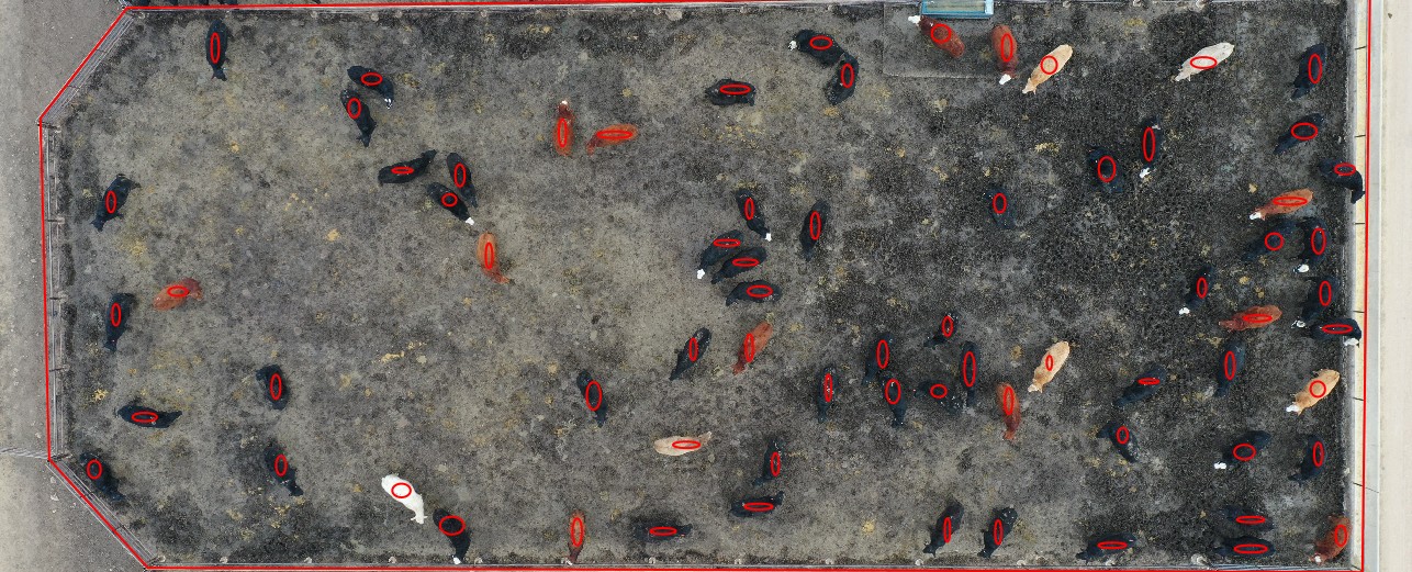
We used oval-shaped annotations as the standard for every animal, as ovals better match the top-down body shape of cattle than rectangles. A single “Cattle” annotation class was defined in QuPath, with standardized color and boundary styling. This visual consistency helped reviewers quickly identify missing or inconsistent labels during quality checks. These rules reduced ambiguity for annotators and made it easier to maintain consistent labeling across multiple images and annotators.
Build a High-Throughput Annotation Workflow
To meet the target of 10,000+ images per month, we deployed a team of six experienced annotators and broke the process into intentional stages:
- Primary Annotation: Each annotator labeled their assigned images following standardized guidelines.
- Quality Review: A secondary reviewer conducted spot checks and made corrections to ensure accuracy remained above 95%.
- Final Export and Formatting: Reviewed datasets were prepared for export and integration into the client’s AI pipeline.
Every annotator received hands-on training using the client’s actual drone imagery to ensure familiarity with lighting, terrain, and herd patterns. We utilized QuPath project templates, allowing each new image batch to automatically inherit the same configuration—classes, annotation styles, and tool settings—eliminating the need for reconfiguration and ensuring consistency across the team.
We set clear daily and weekly targets for each annotator and closely monitored their progress and accuracy. This simple performance tracking helped us maintain both speed and quality as the workload scaled up.
Implement Multi-Layer Quality Assurance
We embedded QA into the workflow to catch issues early and continuously, thereby maintaining high accuracy without requiring rework of large volumes of data.
- Introduced peer review, so selected images from each annotator’s batch were checked by another team member.
- Performed random audits on completed batches to catch systemic issues (e.g., missed animals under certain lighting conditions).
- Captured common error patterns (e.g., confusion with background objects) and upgraded the labeling guidelines and visual references.
Develop a Custom Export Pipeline for COCO JSON
Finally, we ensured that the labeled data could be used directly in the client’s AI training pipeline:
- Used QuPath’s native export (e.g., GeoJSON) as the base format for annotations.
- Developed a custom conversion script to transform these exports into COCO JSON, matching the client’s exact specification for categories, bounding regions, and image references.
- Added validation checks to confirm that every annotated animal in QuPath appeared correctly in the COCO file and that the coordinates and image IDs were accurate and aligned with the original dataset.
This made the handoff to the client’s AI team seamless, ensuring the annotated data could be used immediately for training and validation.
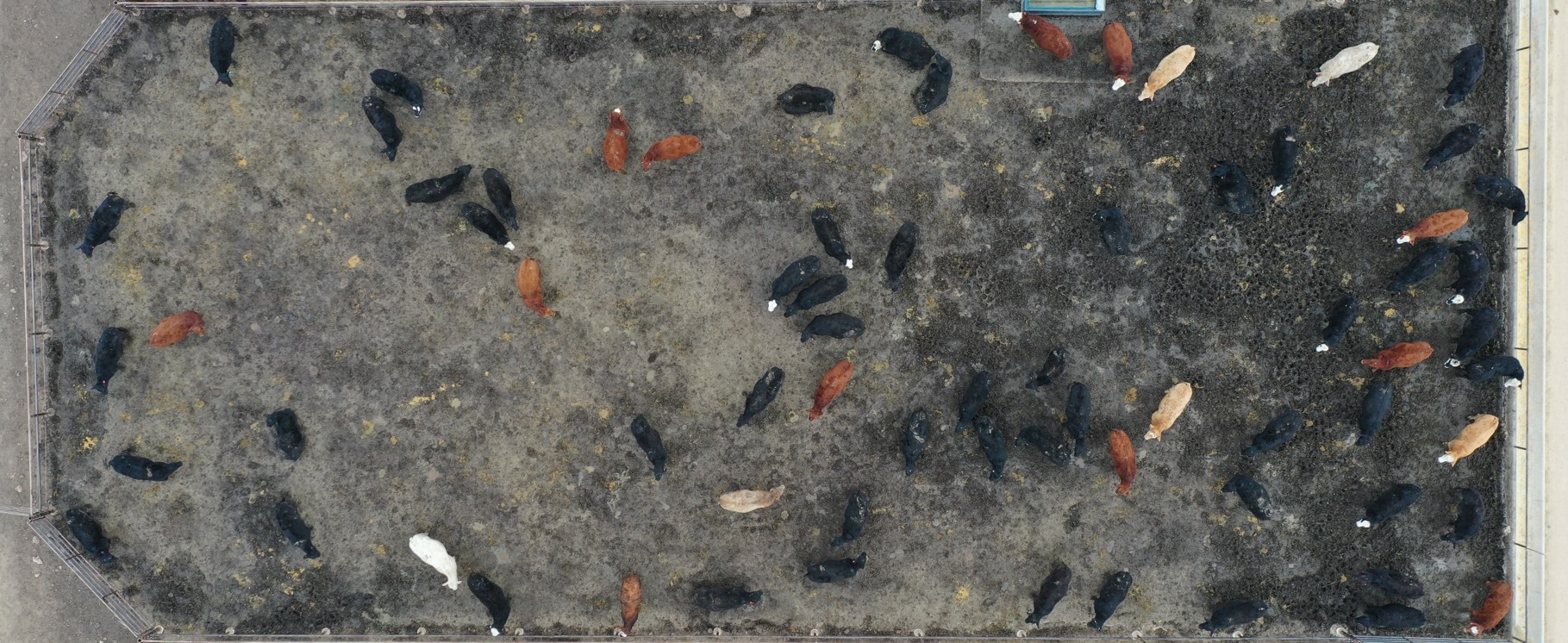
Raw image
Annotated image